
Land Facility is showing how AI and digital tools can deliver practical results for land governance and women’s land and resource rights in West Africa.
Working with our partner Farmerline Group, we have developed the Open Shea Tree Traceability & Tenure Dashboard—the first open-access platform to combine satellite imagery, artificial intelligence, and field-validated data to map shea trees and link them directly to women collectors and cooperatives in Ghana, Benin, and Togo.
About the dashboard
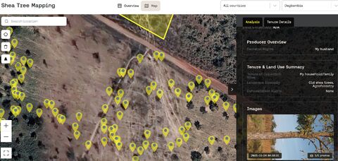
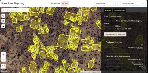
The dashboard uses AI to identify individual shea trees from high-resolution satellite imagery and pairs this with data related to land tenure analysis, decision-making powers, and gender-related dynamics. The result is an interactive, map-based dashboard that provides instant, country- and community-level insights into shea parklands and women’s stewardship.
3-month progress report
- Mapped ~90,000 shea trees across ~2,000 hectares
- Linked ~9,000 women collectors through 40 cooperatives
- Expanded coverage across northern Ghana, Benin, and Togo
Why this matters
The dashboard makes women’s custodianship spatially explicit, verifiable, and visible, and creates an evidence-based foundation for policy and legal reform, sustainable parkland management, and coordination across stakeholders. Shea butter buyers, investors, and regulators can quickly gain a clearer view of land and resource governance, proving that digital tools can improve transparency while reducing the time and costs of establishing and verifying land and tree rights.